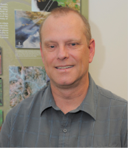
Geneviève de Messières is the lead for the Earth to Sky Interagency Partnership https://earthtosky.org/. She works for Science Systems and Applications, Inc, and is based at NASA’s Goddard Space Flight Center in Greenbelt, MD. Before arriving at NASA, she earned her PhD in astronomy from the University of Virginia and managed the Astronomy Education Program at the Smithsonian National Air and Space Museum. She is a Virginia Master Naturalist and especially likes to engage in local climate solutions, to count birds using eBird, and to identify solutions for light pollution. With Earth to Sky, she is particularly excited to build strong ties with interpreters and communicators across the nation, focusing on making all voices welcome. She enjoys working with the community of NASA-funded earth scientists, identifying their goals and outreach interests, and connecting them with interpreters with a common focus in their place-based work. She looks forward to working with you to improve access to excellent tools for interpreting climate change.

Dr. Eric Brown de Colstoun is a Research Physical Scientist in the Biospheric Sciences Laboratory, NASA Goddard Space Flight Center, Greenbelt, MD. Eric has been working at GSFC for over 20 years. Dr. Brown de Colstoun's expertise in the field of satellite remote sensing is varied, having used data collected at local to continental and global spatial scales, with a variety of instrumentation (laboratory, field, airborne, and satellite). Currently, his research interests include the study of various aspects of land cover, land use, and land cover/use change from the Landsat satellite, as well as the consequences of these changes on the Earth. He recently led a project to map global urbanization from Landsat data for the first time. His other passion is to effectively communicate to a broader non-scientific community what NASA does, what NASA sensors measure, and the significance of this research for societal needs. It is also to engage and inspire the public/students/educators to actively participate in the NASA Earth Science experience as well as STEM careers.
Dr. Brown de Colstoun holds a B.A. degree in Mathematics (1986) from the Colorado College and received his M.A. (1993) and Ph.D. (2001) degrees in Geography from the University of Maryland at College Park.
Abstract:
Geneviève and Eric present on NASA’s extraordinary online library of climate science resources and visualized data and provide a demonstration of the use of a couple of them. They will also discuss ways we can interpret this information for our region and our communities.
At the end of this presentation, participants will be able to:
- Identify and access credible sources of accurate and timely climate change science relevant to their region/site.
- Select at least one relevant, audience-appropriate NASA climate science and/or educational/visual element to use in their program or project.
- Locate and refine selection(s) of NASA climate science and/or educational/visual elements for their program/project
Additional Resources
Right-click link and "Save Link As..." to download resources.
