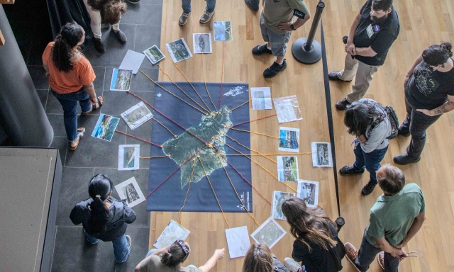
Earth to Sky course participants use a map of Oahu to tell Earth systems stories.
Earth to Sky helps interpreters and informal educators connect the wonder of science with the power of place. Many Earth to Sky community members have used a satellite image from the NASA/USGS Landsat program to bring a broader perspective to their place-based stories.
Option 1: Download an existing NASA/USGS Landsat image:
The Landsat team has collected a library of Landsat images made for Earth to Sky community members around the country, showing New Mexico, Joshua Tree National Park, Mendenhall Glacier, South Florida, and more!
Brand new for 2025 NAI participants: check out the Virginia Beach mosaic here!
Option 2: Make your own Landsat mosaic!
Choose from two tutorials from Earth to Sky, one that uses free, open-source software, or another that uses Photoshop.
Make Connections
Many local print shops can use your image to produce a durable vinyl floor map for all kinds of interactive activities. Landsat imagery has also been used in wayside exhibits in parks around the country.
Find many activities and science resources on the Landsat page, like writing your site's name in Landsat.
Landsat has observed the Earth for over 50 years. A quick way to see how your site has changed over time is Google Timelapse, which uses primarily Landsat data. NASA scientists can help you interpret the changes at your site, as they have in this story about Glacier Bay National Park and Preserve.
Running a training? We have a lesson plan for an icebreaker using a large Landsat floor map that will help your participants build a network of their local Earth systems stories with each other.
Join the Earth to Sky community to collaborate with peers on how to use science from NASA and other trusted sources to enhance your interpretation.
We'd love to help! However you proceed, please This email address is being protected from spambots. You need JavaScript enabled to view it. for help or to let us know what you do with your Landsat image!